Metropolitan Transportation Plan Data Source Guide (Orlando)
This 23-page guide outlines the comprehensive set of data types and their sources used for the Metropolitan Orlando 2045 Plan (January 2020)
This 23-page guide outlines the comprehensive set of data types and their sources used for the Metropolitan Orlando 2045 Plan (January 2020)
The AV Tactical Plan outlines how the City should prepare for AVs and how it can influence the direction of the technology in these early stages. The overall goal is to be proactive, ensuring that Toronto is well-placed to both maximize opportunities and mitigate impacts arising from the arrival of AVs in the City. The tactical plan is keyed to long range 2050 goals, with checkpoints in 2022.
Cities are increasingly establishing key performance metrics (or KPIs) to track performance of municipal functions. Cities typically pick a key goal, associated metrics and benchmarks for success. The tracking system will show how the city is performing relative to the set goal. Scores can be shown for individual functions or as an overall aggregate score.
This 40 page report from Capgemini examines how to address the growing demand for immediate delivery, in particular for groceries, with technology and land uses. This "last mile" delivery refers to the final part of a journey where a customer takes ownership of an ordered product. The report covers five countries and includes the results of research, analysis, and interviews.
The Smart City Explorer is a digital, interactive "textbook" showing various smart city technologies for campuses, greenfield, and brownfield sites. The site was developed by the Smart Cities Council Australia New Zealand and the Place Design Group in 2018. The Explorer is a companion to the Code for Smart Cities guide.
The Bike Sharing World Map collects information on the status of bike share programs worldwide. The map shows self-service automated, advanced automated and mixed automated/manned public use bike-sharing services. The map shows operators, but not the location of available bikes or stations.
Microtransit refers to rides provided by private firms and public agencies in smaller vehicles. While not a new concept, technology has spawned new options by private companies that offer on-demand services and dynamic routing; these services are viewed as a prelude to autonomous shuttle service in the future. Some of these services are partnering with public transit agencies to test whether/how microtransit can work with public transit systems.
Start-up partnerships and collaborations provide cities the ability to trial new services/products with young companies while giving entrepreneurs their first customers in a real world setting.
New Mobility - Autonomous Vehicles and the Region outlines a plan for urban and suburban policymakers to ensure maximum benefit for region’s residents.
Mobility option ratings tools show how walkable and bikeable a place is, as well as the richness of transit options
With dockless bike share systems, bicycles can be parked within a defined district at a bike rack or along the sidewalk With dockless bike share systems, bicycles can be parked within a defined district at a bike rack or along the sidewalk rather than at stations. Dockless bikes can be located and unlocked using a smartphone app. Multiple companies are launching services around the globe.
This White Paper guides cities and towns through the process of setting policies and writing resolutions for new mobility including shared use mobility and autonomous vehicles.
Chatbots are computer programs that leverage machine learning and artificial intelligence (AI) to complete tasks and answer questions while mimicking human conversation.
SUMC’s Shared Mobility Toolkit is designed to help cities and public sector leaders better realize the benefits of shared mobility.
This guide combines policies from the most insightful reports, forecasts, and announcements to produce a compact primer on the future of cities and autonomous vehicles.
A neighborhood innovation lab gathers residents, educators, tech companies, government officials and other stakeholders to solve local problems through data analysis, apps, sensors that monitor neighborhood resources and Internet of Things (Iot) devices.
This report presents & asks for feedback on guidance for how to conduct trials (or tests, demonstrations) for autonomous vehicles around Australia and internationally.
Cycle Atlanta is a smart phone app that collects and reports information to inform decisions on bicycle programs in Atlanta Georgia
The city of Los Angeles California released its first Transportation Technology strategies in September 2016 to weave emerging policy and technology innovation (apps, software, shared use, vehicles, signage, payment ) into local /regional formal transportation plans.
Rideables are portable, motorized devices for travel on streets, sidewalks and paved paths. Also referred to as personal mobility devices. Rideables can include hoverboards, motorized scooters, motorized skateboards and one-wheels. In general, rideables do not include motorized wheelchairs/scooters.
Smart neighborhood pilots test how to arrange smart city technology in order to analyze and address specific goals & problems in a neighborhood.
City72 is an open-source emergency preparedness platform to prepare for emergencies and enact rapid response post-disaster within communities.
Counting Technology from sensors, mobile apps and video systems help transportation planners accurately count travelers on bicycle and on foot.
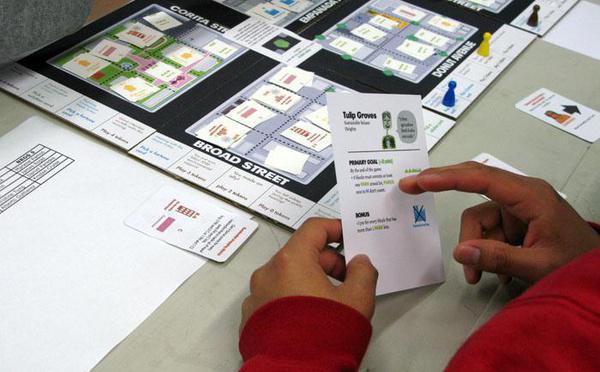
Blocks & Lots is a game about land use, politics and urban redevelopment. Users can play online or download the game, instructions and cards free.